Important notice: Before traveling to Russia, install a VPN to access apps like Instagram, YouTube, Telegram and WhatsApp. However, please note that our website may not load properly when a VPN is active — disable it while browsing our site. We also recommend downloading offline maps, as mobile internet can be unreliable outside major cities.

Bolshiye Koty Settlement

Bolshiye Koty Settlement

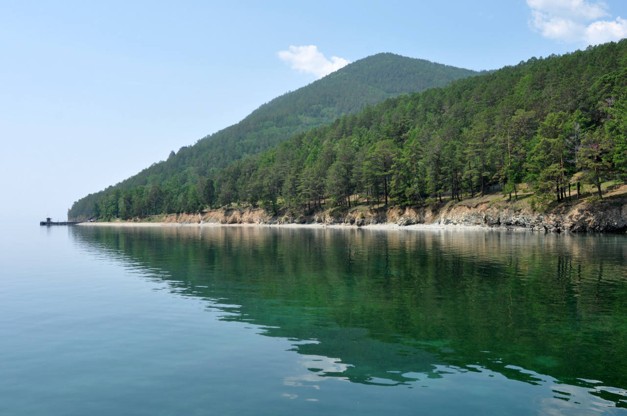
Bolshiye Koty is a small former gold-mining settlement on the shore of Lake Baikal, about 20 km from Listvyanka. No road leads to it, so it is reached on foot along the lakeshore trail or by boat. That is why the landscape around it is still so quiet. Visitors come for the hike, the views from the ridge above the lake, the old gold-mining sites and a small Baikal museum.

Bolshiye Koty at a glance

  • 📍 Where: western shore of Lake Baikal, about 20 km from Listvyanka and roughly 90 km from Irkutsk by the route people travel
  • 🥾 Main activity: the eco trail between Listvyanka and Bolshiye Koty, walkable in a day in either direction
  • ⛴ Getting there: by boat from Irkutsk in summer; by boat or on foot from Listvyanka
  • ⏱ Time needed: a day is enough; two days if you want to see everything and stay overnight in a guesthouse or tent

Where does the name come from?

The name means “Large Cats” in Russian, but the village was almost certainly not named after animals. The most accepted explanation is that it was named after the river it stands on, and that the word koto comes from the Evenki language, where it is thought to mean “palm” or “knife”. Another theory links it to the wooden shoes called koty that people wore in wet, marshy weather. The true origin is unknown.
What to see in Bolshiye Koty

🥾 The eco trail from Listvyanka

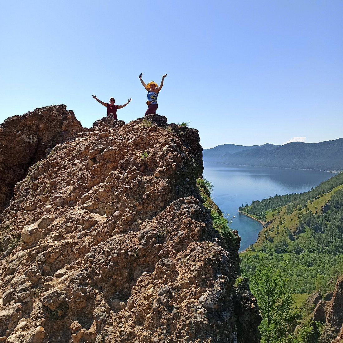
The trail belongs to Baikal’s Pribaikalsky National Park. In Listvyanka, walk towards the market from the last bus stop or the quay and turn right onto Gudina Street. After about 2 km you reach the start of the path and cross the stream on its left side. The first 4.5 km climb steadily, and this is the hardest part. Near the top the path splits; take the right-hand branch. At the summit (about 860 m above sea level, around 400 m above the lake) you get wide views over Lake Baikal.

The path then follows the shore, crosses streams on bridges built by volunteers, and in a few places runs along cliffs, so watch your step. You can also walk it in the opposite direction, starting from Bolshiye Koty.

A paid visitor permit is required for the park. Foreign visitors pay a few hundred rubles, valid for about a week, and can buy it online at baikalpass.ru.

🏞 Skriper Cliff

Skriper Cliff stands about 4 km from the village (coordinates: 51.8981° N, 105.1320° E). About 200 m up the cliff is a cave of around 60 m² with two small halls, where archaeologists have found old tools, jewelry and utensils. You can see the entrance from the lake.

The name comes from the 19th-century gold mine in the area, where work was done with a scraper machine (skreper). In 1891 alone, gold diggers washed more than a million poods of sediment (1 pood is about 16 kg) and recovered about 28 Russian pounds of gold, roughly 11 kg. The scraper machine stood for many years as a local landmark.

🐟 Museum of Baikal Studies and the Biological Station

The biological station has worked in Bolshiye Koty since the early 20th century. Its small museum, named after the scientist M. M. Kozhov, has several hundred exhibits, a large insect collection and paintings by the museum’s founder. It stands about 100 m from the pier. Opening hours are irregular and visits are usually arranged in advance, so ask your guide or boat operator before you count on it.

⛏ Traces of gold mining

All around the valley you can still see artificial lakes and piles of rock left by gold miners. Together with the lake views, they make Bolshiye Koty a good place to slow down for a few hours.

How to get to Bolshiye Koty

From Irkutsk by boat (summer). From about June to late September, a catamaran and a hydrofoil run from the Raketa pier in Irkutsk (98/1 Marshala Zhukova Ave), stopping in Listvyanka on the way. The trip takes roughly 1 hour 45 minutes one way. Adult tickets cost around 3,000 RUB each way (about half that for children) and can be bought at the pier or on board. The boat usually stays for the day and returns in the evening, with an earlier departure in autumn. Check the operator’s timetable (in Russian), as sailings depend on weather and season. See also our Irkutsk transport guide.

From Listvyanka. Take a bus from Irkutsk to Listvyanka (about 1–1.5 hours), then go on by private boat (about 30 minutes) or walk the eco trail. Private boats are mostly available in summer and you usually need to ask at the pier or book ahead.

In winter. The frozen lake is used as a road to the village, marked with signs along the shore. Ice conditions vary, so go only with a local driver or guide.

Frequently asked questions

  • Can you drive to Bolshiye Koty? No. There is no road, only the lakeshore trail and boats. In winter, vehicles use the lake ice.
  • How long does the hike from Listvyanka take? About 20 km, which most people walk in a day. The first 4.5 km are a steady uphill, so start early.
  • Can I visit Bolshiye Koty as a day trip from Irkutsk? Yes, in summer. The boat from Irkutsk leaves in the morning and returns in the evening, which leaves a few hours on the ground. Two days are more comfortable if you want to hike.
  • Where can I stay? There are guesthouses and camping areas in the village. Book ahead in July and August.
  • Do I need a permit? Yes. The trail and the surroundings are part of Pribaikalsky National Park, so a visitor permit is required.

    Prices and timetables change, so please check the operators’ websites before you travel.

Didn't find a suitable tour?

Check out the full list of the most interesting tours in Russian cities.

Book the tour

✓

Thank you!

The form was sent successfully. We will contact you shortly.